October 9, 2026
What Is Geofencing? How UAE Fleets Use Virtual Boundaries for Security, Compliance and Productivity
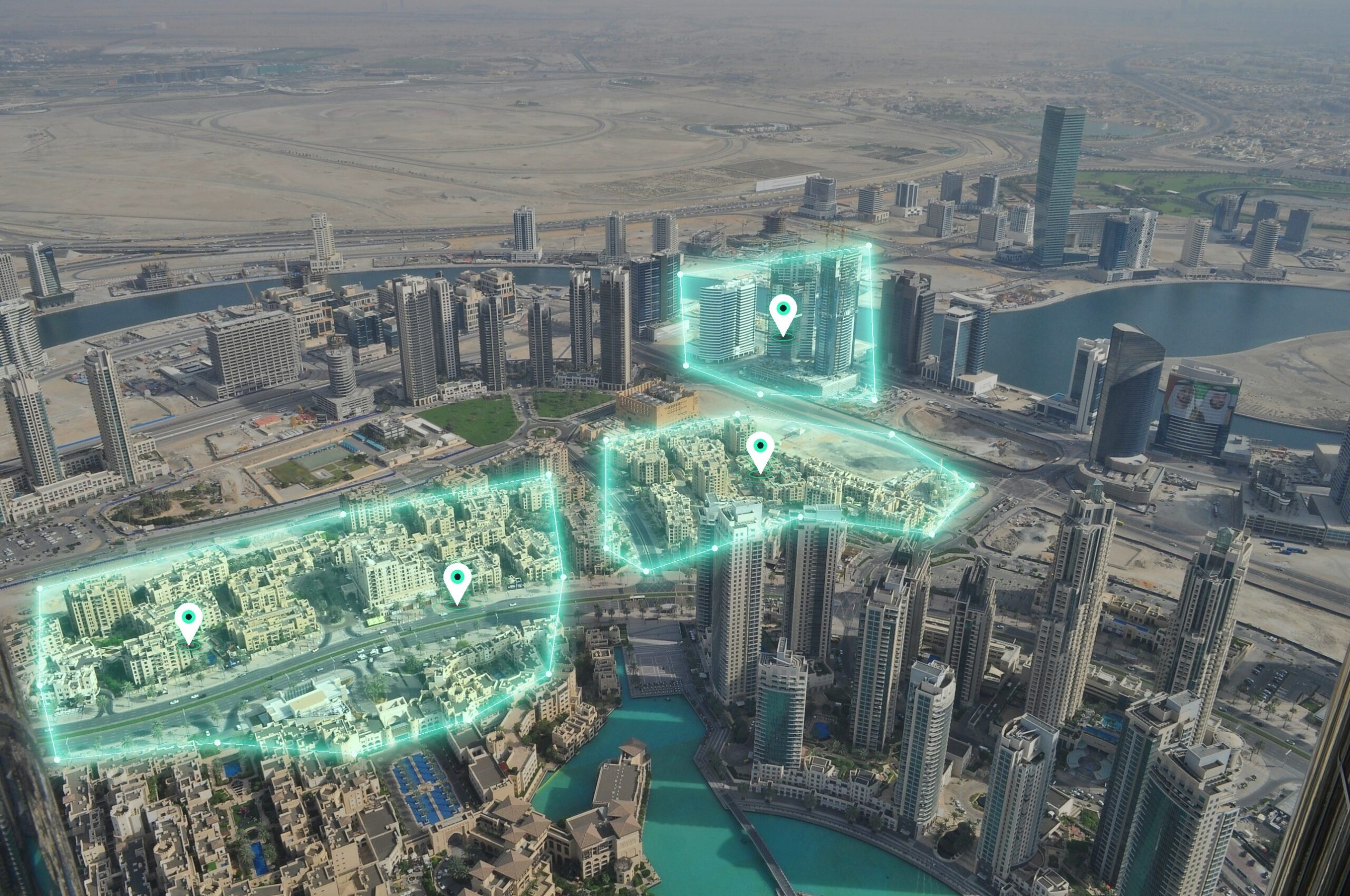
Geofencing is a virtual boundary drawn around a real-world location that automatically triggers an alert or action when a vehicle enters or exits it. For a fleet operator, that boundary can surround a depot, a client site, a border crossing or a restricted work area. The vehicle’s tracking device reports its position, the system compares that position with the boundary, and the right person is notified without anyone watching a map.
Most definitions of geofencing (also written geo fencing) focus on smartphones, retail marketing and app notifications. They say little about what a UAE fleet manager actually needs to control: vehicles used outside approved hours, movements across GCC borders, arrival times at customer sites. This article covers how geofencing works and how UAE fleets apply it to security, compliance and daily operations, using data from a GPS tracking system.
How Geofencing Actually Works
A geofence is built from three parts: a boundary, a position source and a rule.
The boundary is defined by GPS coordinates. It can be a circle with a set radius around a point, or a custom shape drawn on a map to follow a yard perimeter, an industrial site or a stretch of road. Fleet managers create and name these zones in the tracking platform.
The position source is the tracking device installed in the vehicle. It reads GPS coordinates continuously and reports them to the platform at a set interval. The platform, or in some systems the device itself, checks each new position against every active boundary.
The rule defines what happens when the check detects a crossing. The vehicle entering a zone, leaving it, or staying inside longer than a set time can each trigger a different response: a geofence alert sent by SMS or email, a dashboard notification, a log entry, or an entry in an automated report.
The result is a record of movement against places that matter to the business, not only a dot on a map. The sections below show how that record is used.
Security Use Cases for UAE Fleets
Security is the most direct application of geofencing, because the rule is simple: a vehicle should or should not be in a given place at a given time.
Unauthorized vehicle use. A geofence around an operating area, combined with a schedule, flags vehicles that move outside approved hours or beyond approved areas. A pickup that leaves the depot at 11 p.m. on a Friday, or a service van found on the other side of the emirate on a day off, generates an alert at the time it happens. Without the geofence, the same movement appears only in a report reviewed later, if at all.
Theft recovery. If a vehicle leaves its designated zone unexpectedly, the system alerts the fleet manager at the moment it crosses the boundary. The live position then supports recovery. Response time is the main variable in recovering a stolen vehicle, and a boundary alert shortens the interval between the event and the first notification.
Restricted sites. Some work sites, including ADNOC facilities and other regulated locations, restrict who and what may enter. For contractors, unauthorized entry is itself a compliance problem, regardless of intent. A geofence around the site perimeter can alert the operator when a vehicle that is not assigned to that site crosses the boundary, so the movement can be queried before it becomes an incident.
Compliance Use Cases
Geofencing also produces records that regulators and clients ask for, which makes it a compliance tool as well as a security one.
Cross-border GCC route monitoring. Fleets operating between the UAE, Oman and Saudi Arabia can place geofences along border crossings and receive an alert when a vehicle enters another country. This applies to fleets working to Oman’s safety requirements, such as OPAL-compliant fleets, where route adherence and trip records are part of the audit trail.
Journey management. Geofenced checkpoints along a planned route confirm that a vehicle followed the approved journey management plan. If the vehicle passes each checkpoint within the expected window, the log is built automatically. If it deviates, the supervisor is told while the journey is still in progress. This is a natural extension of a journey management system, where the plan is defined before departure and verified during it.
Site check-in and check-out. Oil and gas contractors are often required to show when vehicles were on a client site. Geofences at site gates record entry and exit times without relying on drivers to log them by hand. For fleets working toward an ADNOC-approved IVMS, these time-stamped records support the evidence a fleet operator is expected to keep.
Speed Limit Geofences and In-Cabin Alerts
Geofences can also enforce a speed limit that applies only inside a defined zone. This matters for compliance because some client and regulator requirements, including ADNOC IVMS requirements, set a speed limit for a site or route that does not match the posted road limit. The required limit is usually lower, and the driver is expected to follow it regardless of the road signs.
The setup has two steps. The operator draws a geofence around the site, access road or route segment and assigns it the required speed limit. The IVMS then compares the vehicle’s speed with that limit for as long as the vehicle is inside the zone.
The type of device determines what happens next. A regular GPS tracker records the overspeed event and sends it to the platform, where it appears in a report. The driver learns about the violation after the trip, when the event can no longer be corrected. A purpose-built IVMS device can trigger an audible alarm inside the vehicle at the moment the limit is exceeded, so the driver reduces speed immediately. The event is still logged for the report and for the audit record.
This difference is relevant when choosing hardware. If the requirement is to control speed in the zone, and not only to document violations afterwards, the device must be able to alert the driver in real time inside the cabin.
Productivity and Operations Use Cases
The same technology removes manual reporting from everyday fleet work.
Automated arrival and departure timestamps. For delivery and last-mile delivery fleets, a geofence around each customer address or distribution point records when a vehicle arrives and leaves. Drivers no longer need to call in or fill out a form, and dispatchers work from timestamps generated by the vehicle’s position instead of from memory or estimates. Dwell time at each stop becomes measurable, which shows where routes lose time.
Depot and yard monitoring. A geofence around a depot or yard shows how many vehicles are inside, when each left and when each returned. Fleet managers can compare actual departure times with the planned schedule and see which vehicles routinely leave late or return after the yard closes.
Customer notifications. A geofence placed a set distance from a customer site can trigger an automatic message when the delivery vehicle crosses it. The customer is told the vehicle is nearby and can prepare to receive the goods. This reduces failed deliveries and waiting time at the door, and it gives the operator a measurable basis for service level agreements.
See geofencing in action on FMSi’s platform
Car Rental-Specific Use Case: Recovery and Zone Restriction
Car rental companies carry a risk that most fleets do not: the vehicle is in the hands of a customer, and the operator cannot see where it is going without telemetry.
Geofencing addresses two problems. The first is zone restriction. A rental agreement may prohibit taking a vehicle across an international border, for example from the UAE into Oman or Saudi Arabia. A geofence along the border sends an alert when the vehicle approaches or crosses it, so the operator can contact the customer immediately instead of discovering the breach on return.
The second is recovery. If a vehicle leaves the agreed operating area, or is not returned at the end of the contract, the geofence alert and live position give the operator a starting point for recovery. The record of when the boundary was crossed also supports any claim under the rental agreement.
For more on how FMSi supports this sector, see how fleet management solutions help car rental companies in the UAE.
Setting Up Geofences: What to Get Right
A geofence is only as useful as its configuration. Three decisions matter most.
Zone size. A zone drawn too tightly around a site produces false alerts, because normal GPS position variation can place a parked vehicle briefly outside the boundary. A zone drawn too loosely defeats the purpose, since a vehicle can be well outside the intended area before an alert fires. Draw boundaries to follow the real perimeter, with a small margin, and test them with a vehicle before relying on them.
Alert routing. Decide who is notified and how. Security alerts for after-hours movement may need an SMS to a duty manager. Arrival and departure events may only need to appear on the dashboard and in a daily report. Sending every alert to every person leads to alerts being ignored.
Regular review. Operations change. Depots move, customers are added, and sites open and close. Review zones on a fixed schedule and remove those that are no longer in use, so that the alerts that remain are ones someone acts on.
Frequently Asked Questions
What is geofencing in a car? Geofencing in a car means that the vehicle’s GPS tracking device is checked against a virtual boundary. When the vehicle enters or leaves that boundary, the system sends an alert or records an event. The boundary is set in the tracking platform; nothing is built into the vehicle’s body.
How accurate is geofencing? Accuracy depends on the quality of the GPS signal. In open areas, GPS positions are typically accurate to a few meters. Near tall buildings, in tunnels and in covered yards, accuracy falls, and positions can drift. This is why zones should include a margin and why very small geofences produce false alerts.
What is a geofence alert? A geofence alert is a notification sent when a vehicle crosses a defined boundary, entering, leaving or remaining inside a zone for longer than a set time. It can be delivered by SMS, email or the platform dashboard.
Can geofencing work without internet connectivity? Partly. The vehicle’s device can read GPS positions without a mobile data connection, but it needs that connection to send the position to the platform. In remote areas of the UAE and across the GCC with weak or no coverage, real-time alerts are delayed or not delivered. Many devices store positions and upload them when coverage returns, so the event is recorded, but it is not received as a live alert. Fleets that operate in remote areas should check coverage on their routes before relying on real-time geofence alerts.
Conclusion
Geofencing turns locations into rules. For UAE fleets, those rules support security through after-hours and restricted-site alerts, compliance through border, journey and site records, and productivity through automatic timestamps and customer notifications. Car rental operators add zone restriction and recovery. The value depends on sensible zone sizes, clear alert routing and regular review, and on knowing where mobile coverage limits real-time alerts.
Set up geofencing for your fleet
Related Blogs

CAN Bus Data in Fleet Telematics: What Your Vehicles Are Telling You
Every modern commercial vehicle generates a constant stream of internal diagnostic data, whether or not anyone is reading it. Engine sensors, brake systems, and dozens of other electronic components are exchanging information every second the vehicle runs.
Vehicle Tracking System vs. Fleet Management System: What UAE Fleets Need
Search “vehicle tracking system” in the UAE and the results range from a AED 50/month dongle that pins a dot on a map to enterprise platforms quoting five figures a year.

Reckless Driving in the UAE: Fines, Black Points & How Fleets Prevent It
One conviction for reckless driving in the UAE comes with an AED 2,000 fine, 23 black points, and a 60-day vehicle impoundment. That’s not a typo, and it’s not the ceiling for speeding or a missed seatbelt – it’s a single violation, and it puts a license one point away from suspension.
Fuel Management System for UAE Fleets: Cut Fuel Costs by Up to 30%
Fuel is the least predictable line item in a UAE fleet budget. Between March and June 2026, petrol and diesel prices rose more than 60% due to disrupted regional supply.